
Agricultural Masterplan · Sabya, Jazan
Nakhlan — Masterplan and architectural vision for an agricultural destination
Developing an integrated vision that links agricultural production, operational facilities and the public frontage within one unified masterplan, then translating it into a model and visual outputs that explain the project.
- → Location
- Sabya, Jazan, Saudi Arabia
- → Year
- 2026
- → Type
- Independent architectural project
- → Role
- Masterplanning & visualisation
My scope
Masterplanning, architectural design development, modelling and project presentation, covering:
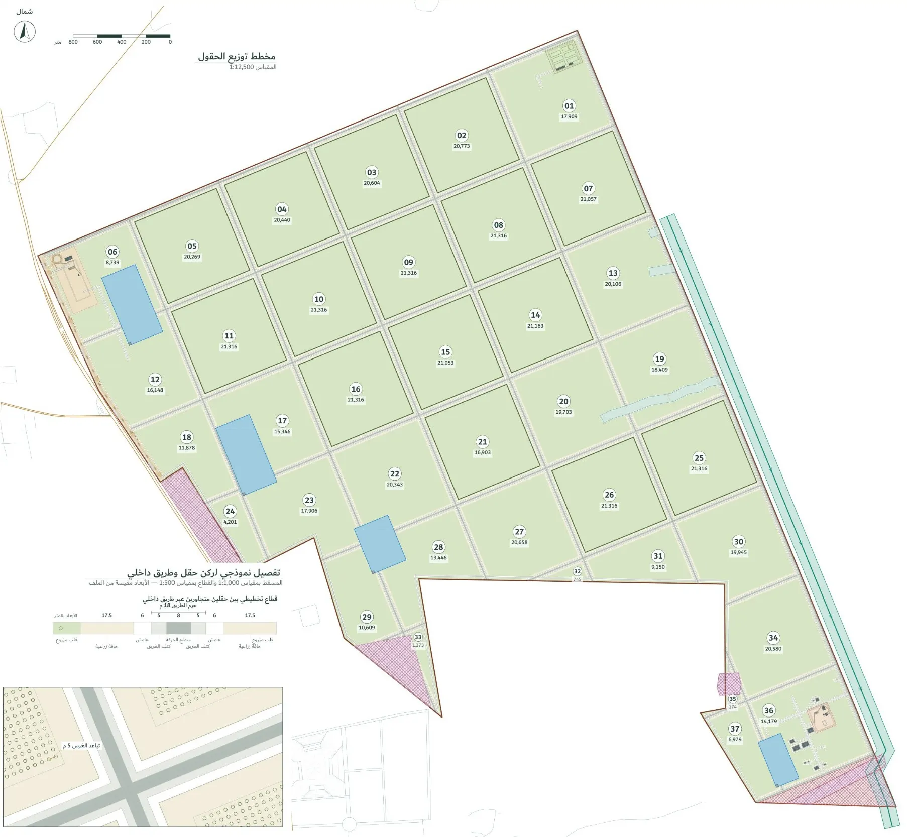
- Masterplan development and distribution of the mango fields
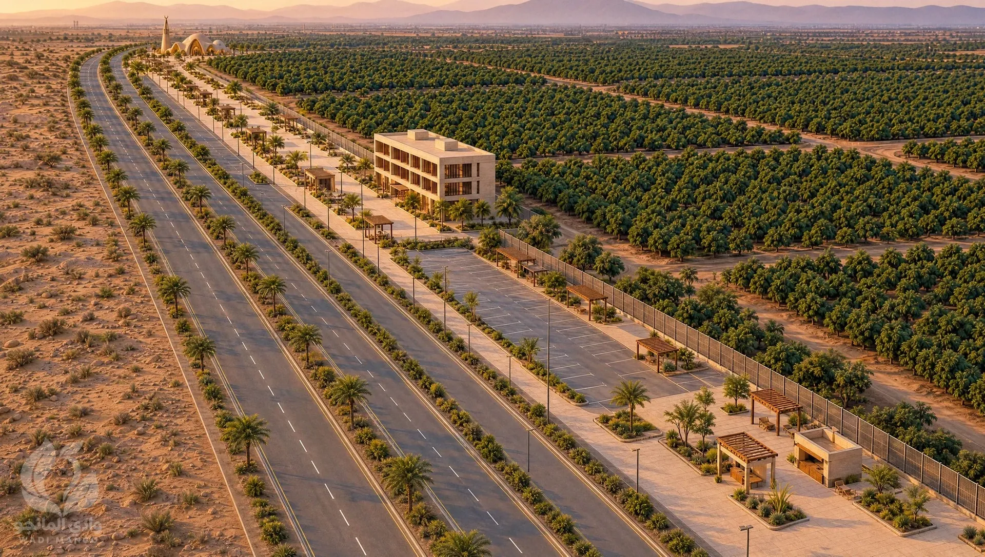
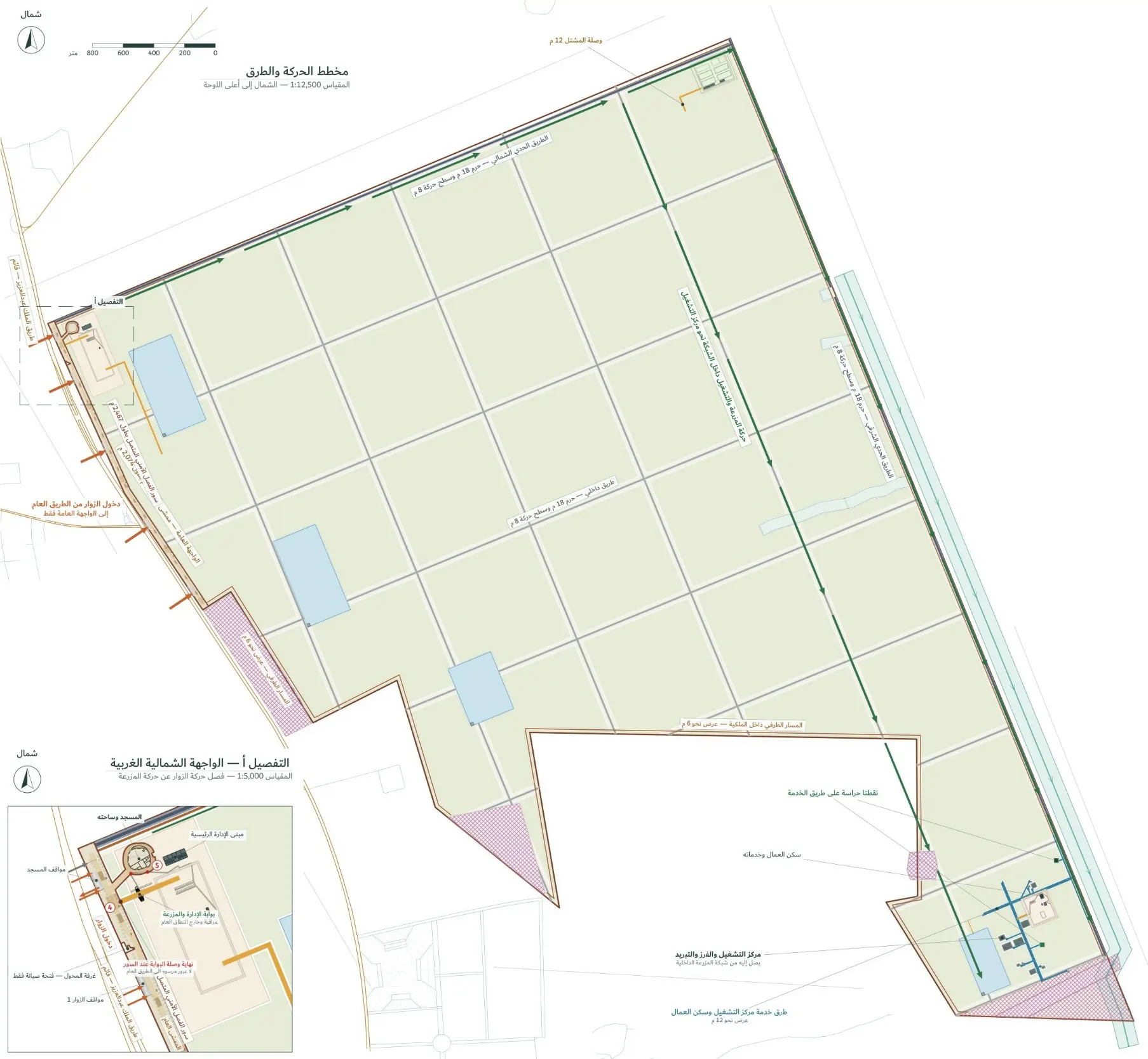
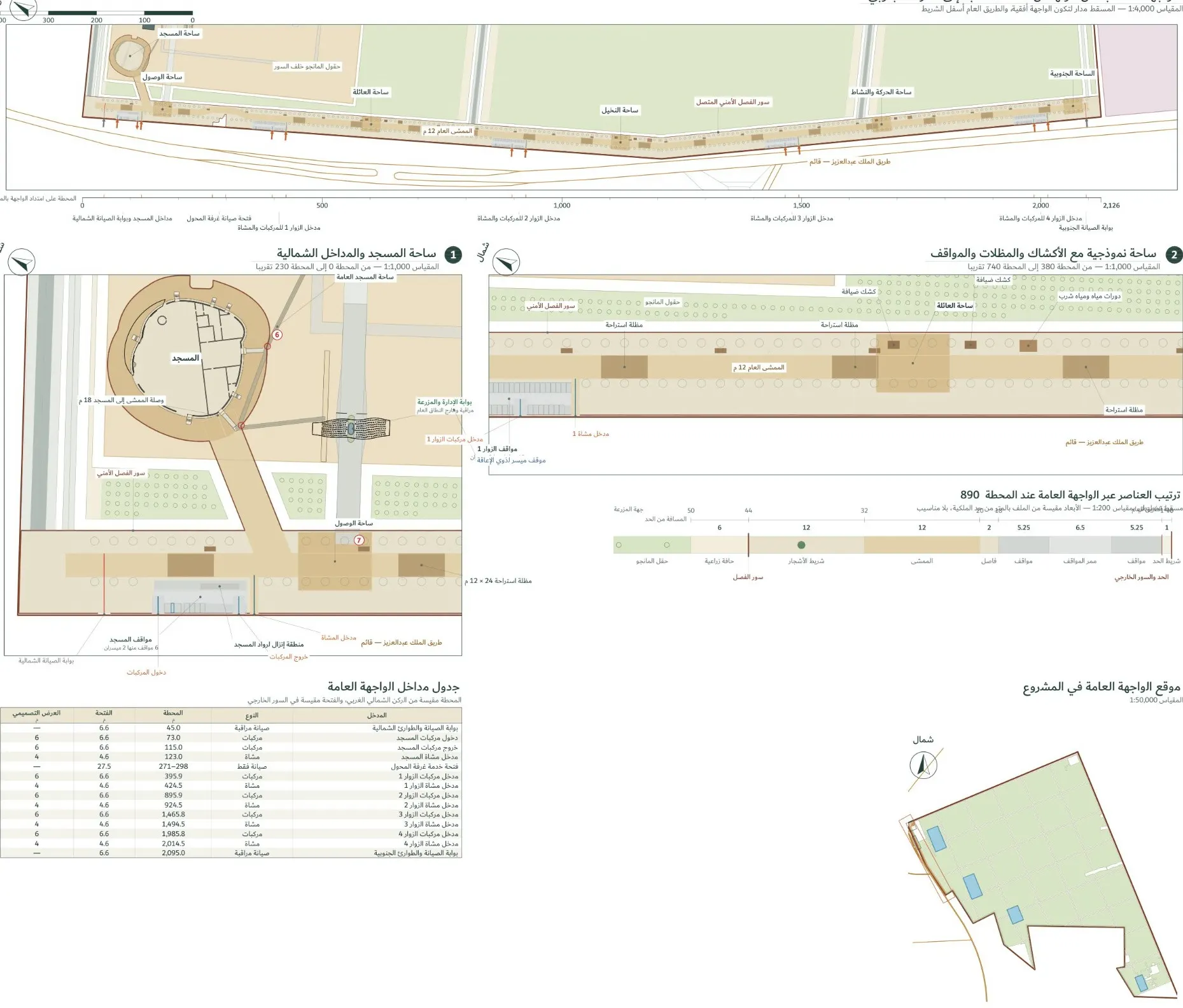
- Internal roads and the public boulevard
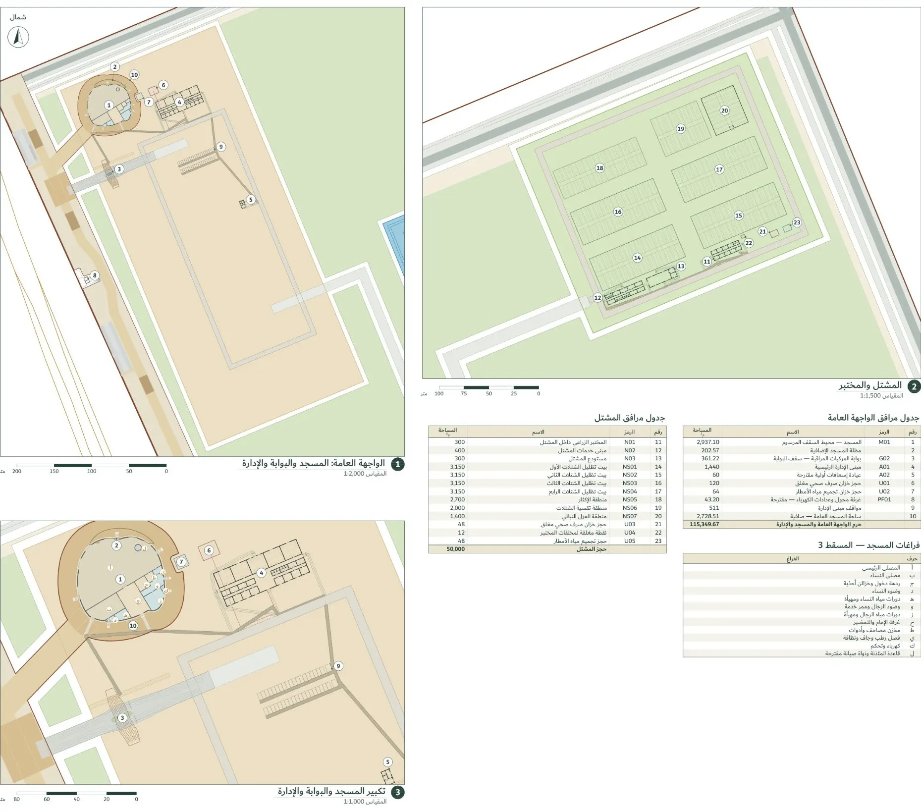
- Mosque, main gate and administration building
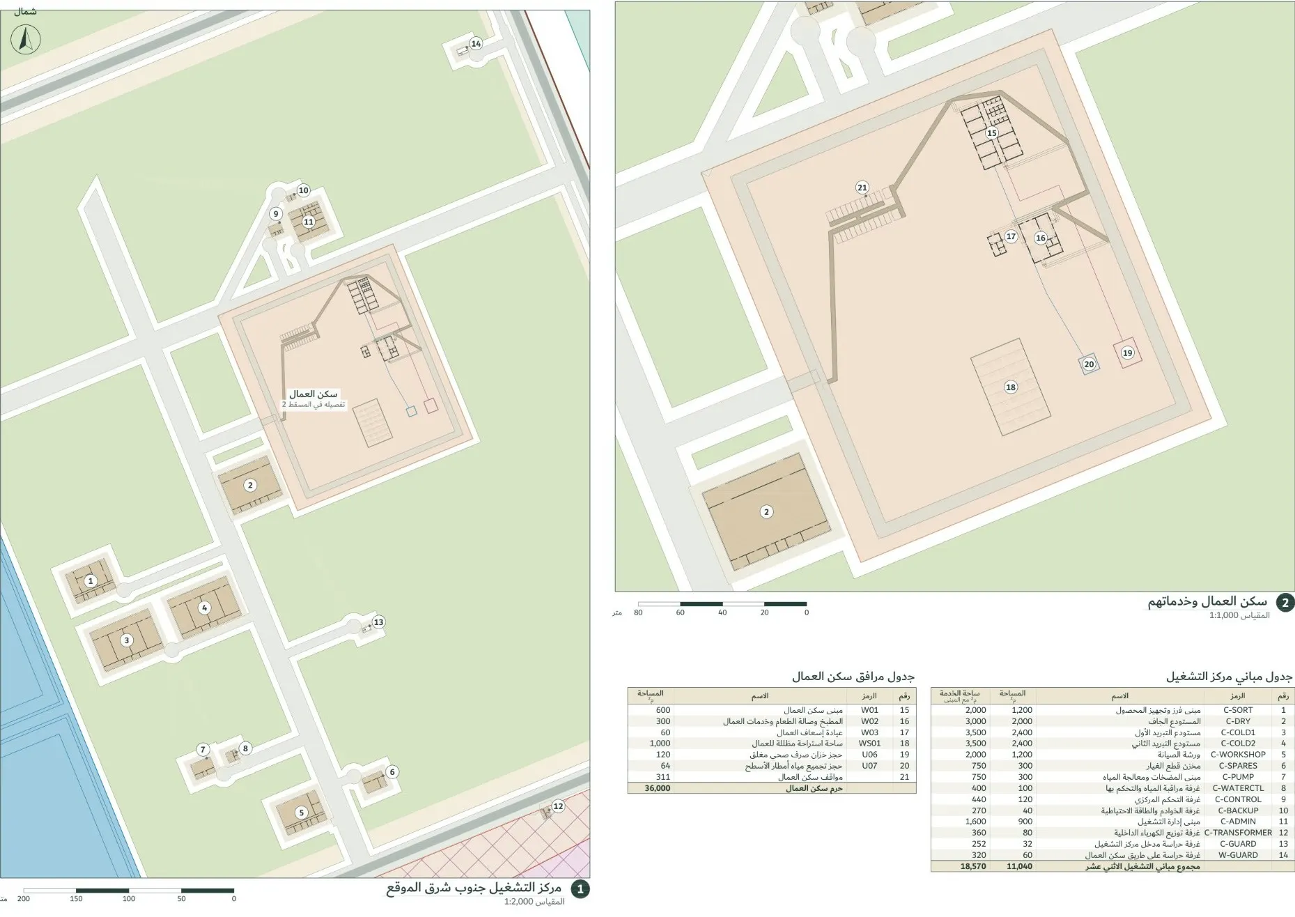
- Nursery, operations facilities and workers’ accommodation
What I delivered
- A unified masterplan linking agricultural production, operational facilities and the public frontage
- Architectural design development of the main buildings and elements
- Project modelling in Revit
- Architectural visualisations of the boulevard, gate, administration and water basins
- Preparation of presentation and film materials for the project
- A 21-slide masterplan presentation covering land-use tables, the water strategy and building plans
Architectural visualisation
Public frontage, facilities and resources
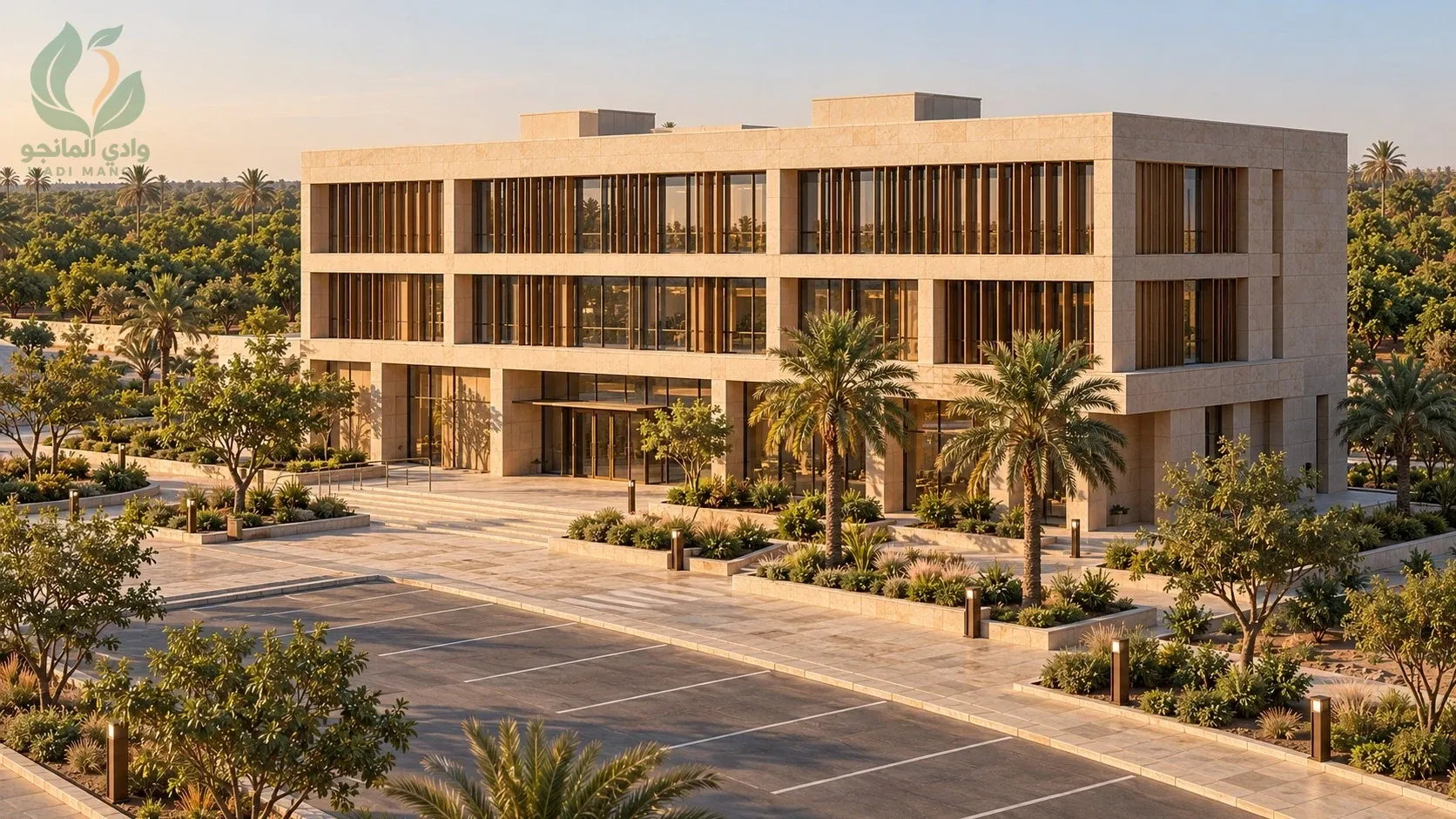
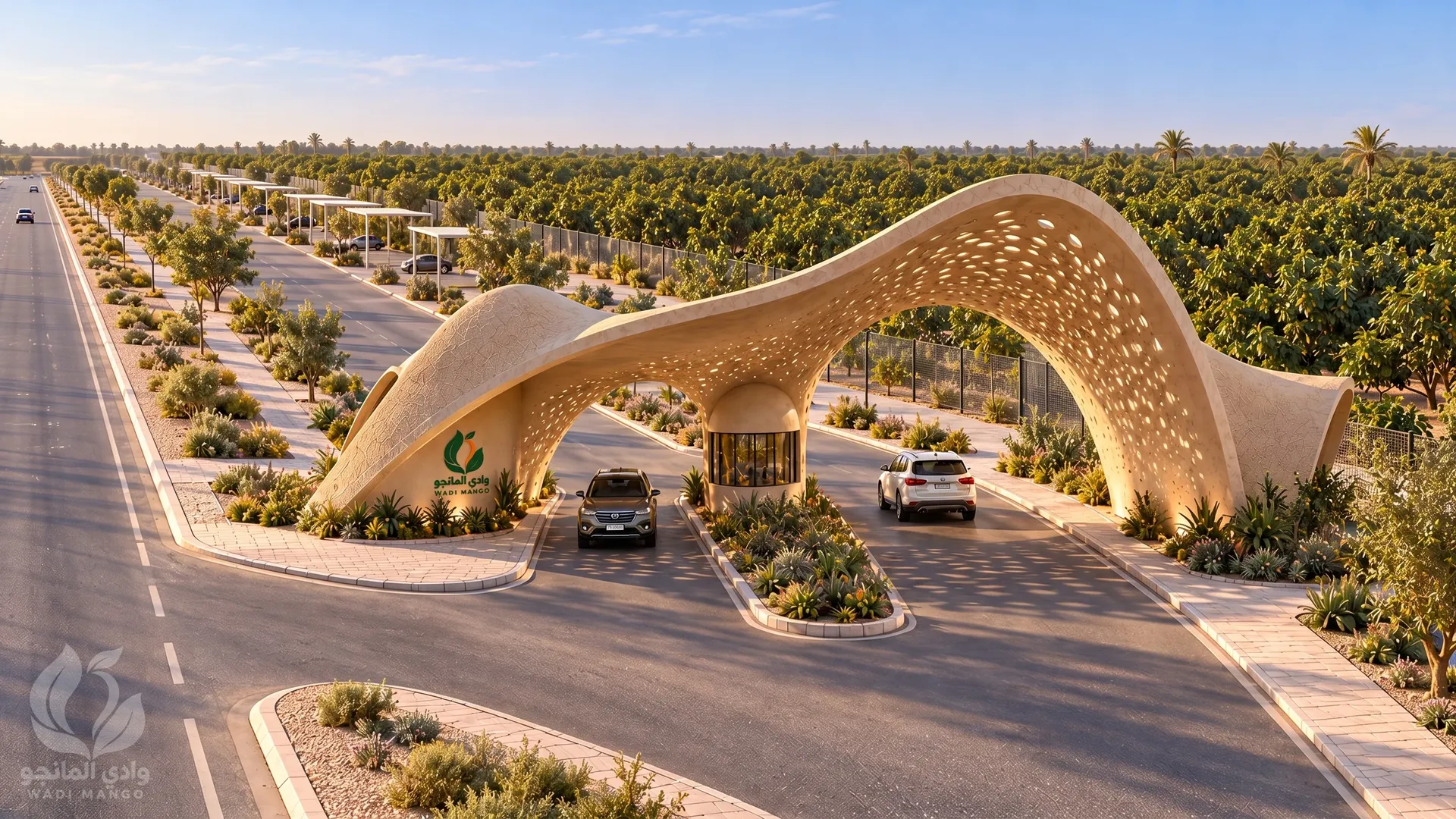
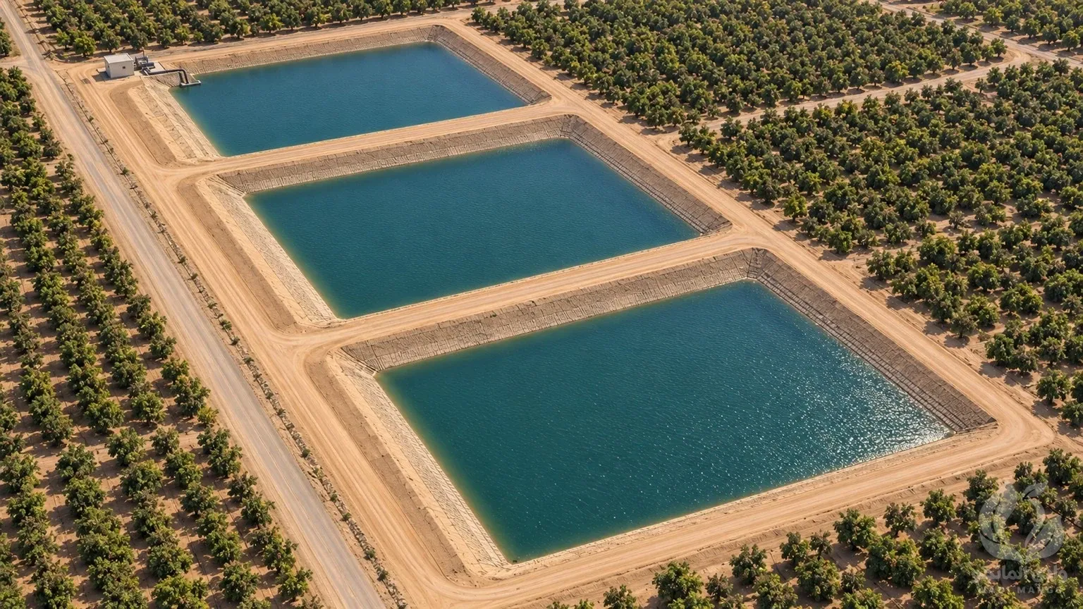
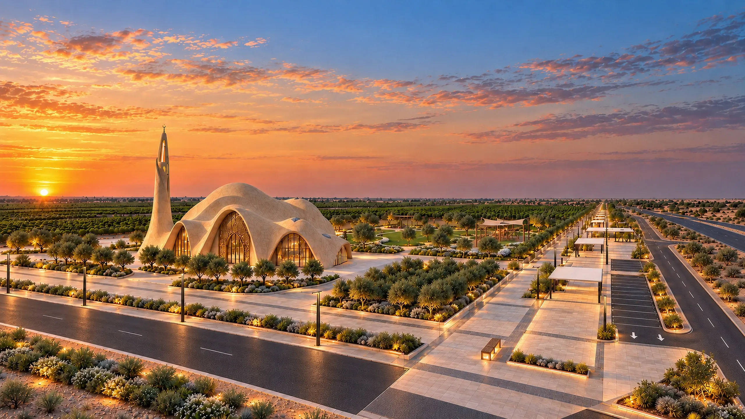
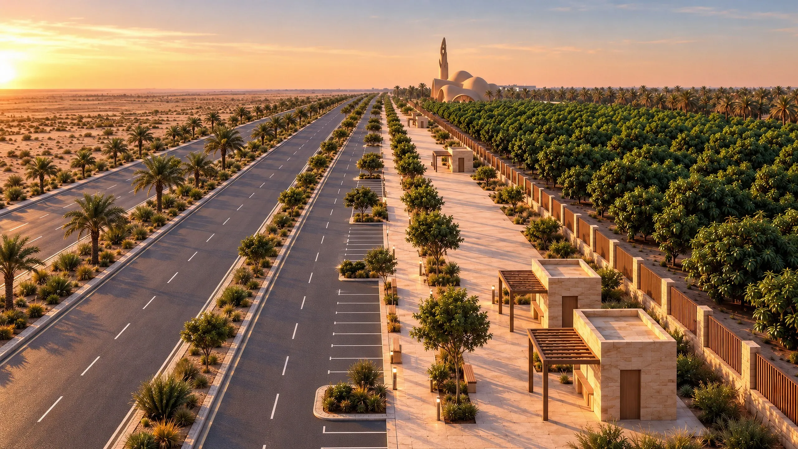
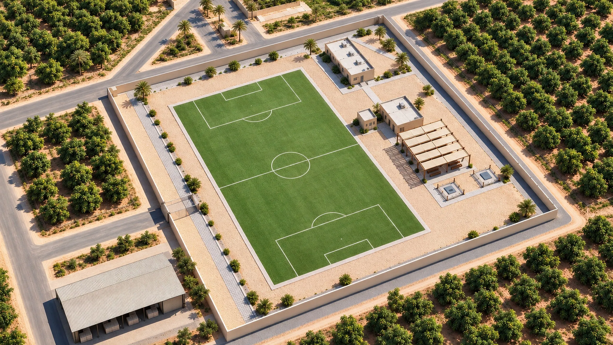
All images are architectural visualisations, not site photographs.
Masterplan presentation · October 2026
Nakhlan Agricultural City — Masterplan
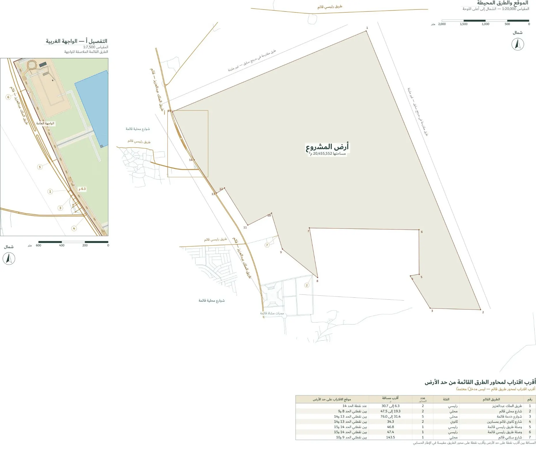
An integrated mango farm on more than twenty million square metres: visitors arrive through a public frontage on King Abdulaziz Road, while the farm operates internally on its own roads and services.
20,455,552
m² site area by the coordinate polygon
600,000
mango trees
37
agricultural fields
76.55%
of the land actually planted
1,096,581
m³ rainwater storage in 4 basins
2,074
m public-frontage promenade
The brief states 20,295,111 m²; the 160,441 m² difference requires survey confirmation.
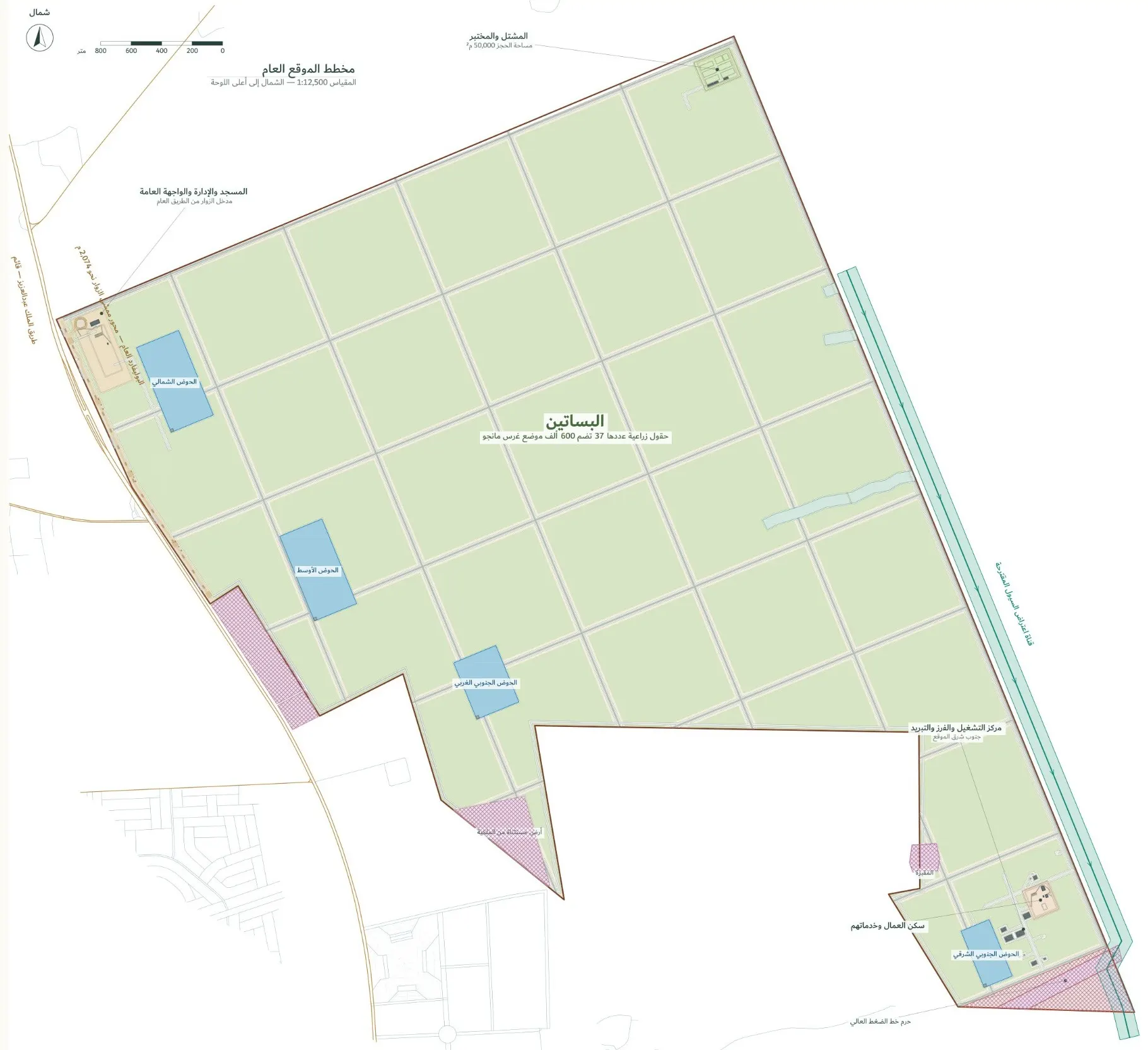
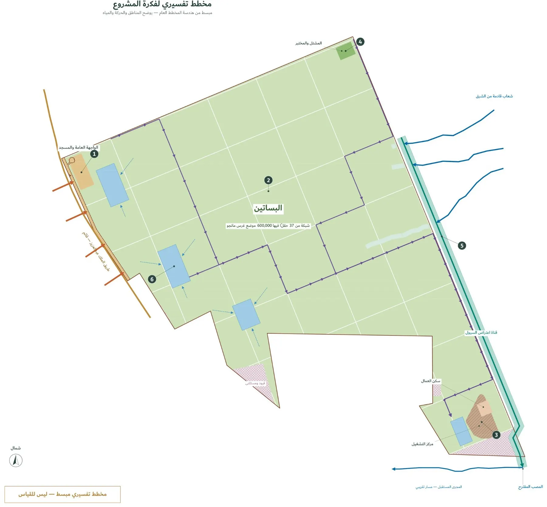
Every function in its place
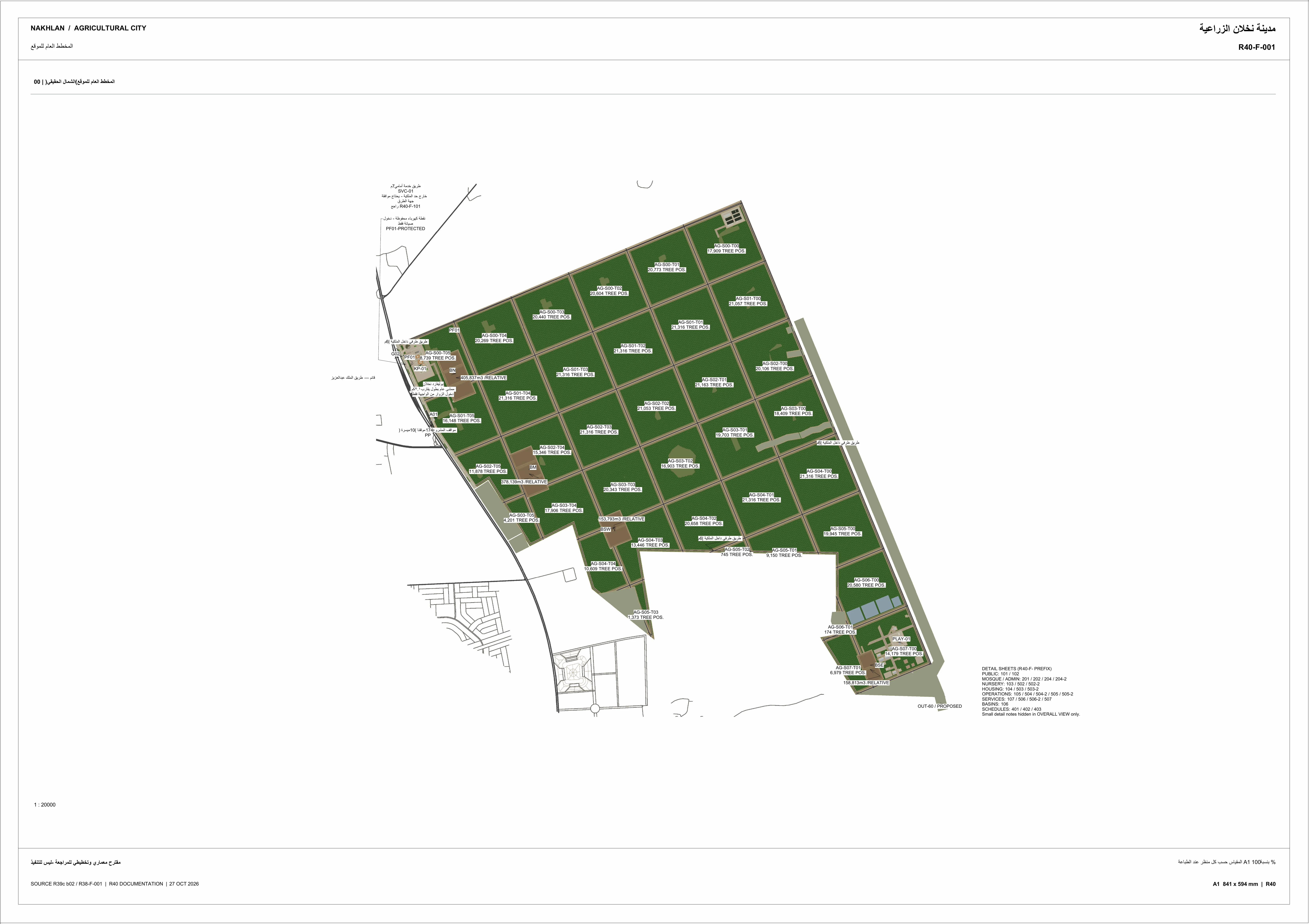
- Orchards at the heart, on a regular field grid that starts from the site boundary
- The public frontage to the west on the road, with the mosque, administration and boulevard
- The operations centre and workers’ housing to the south-east, on service roads
- The nursery and laboratory to the north-east
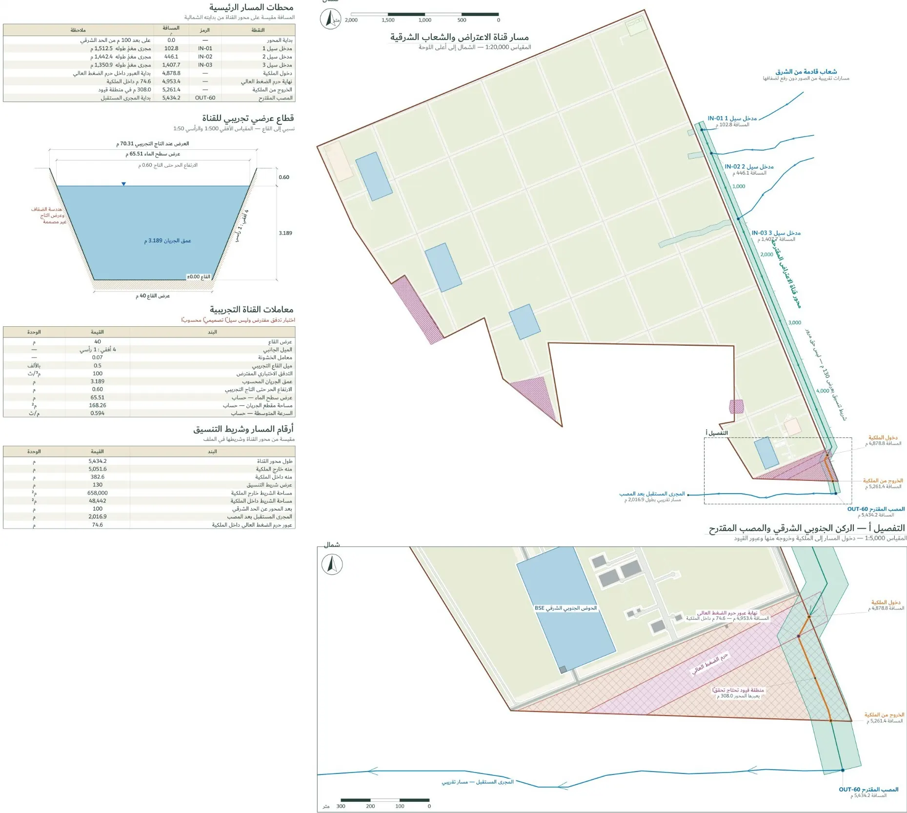
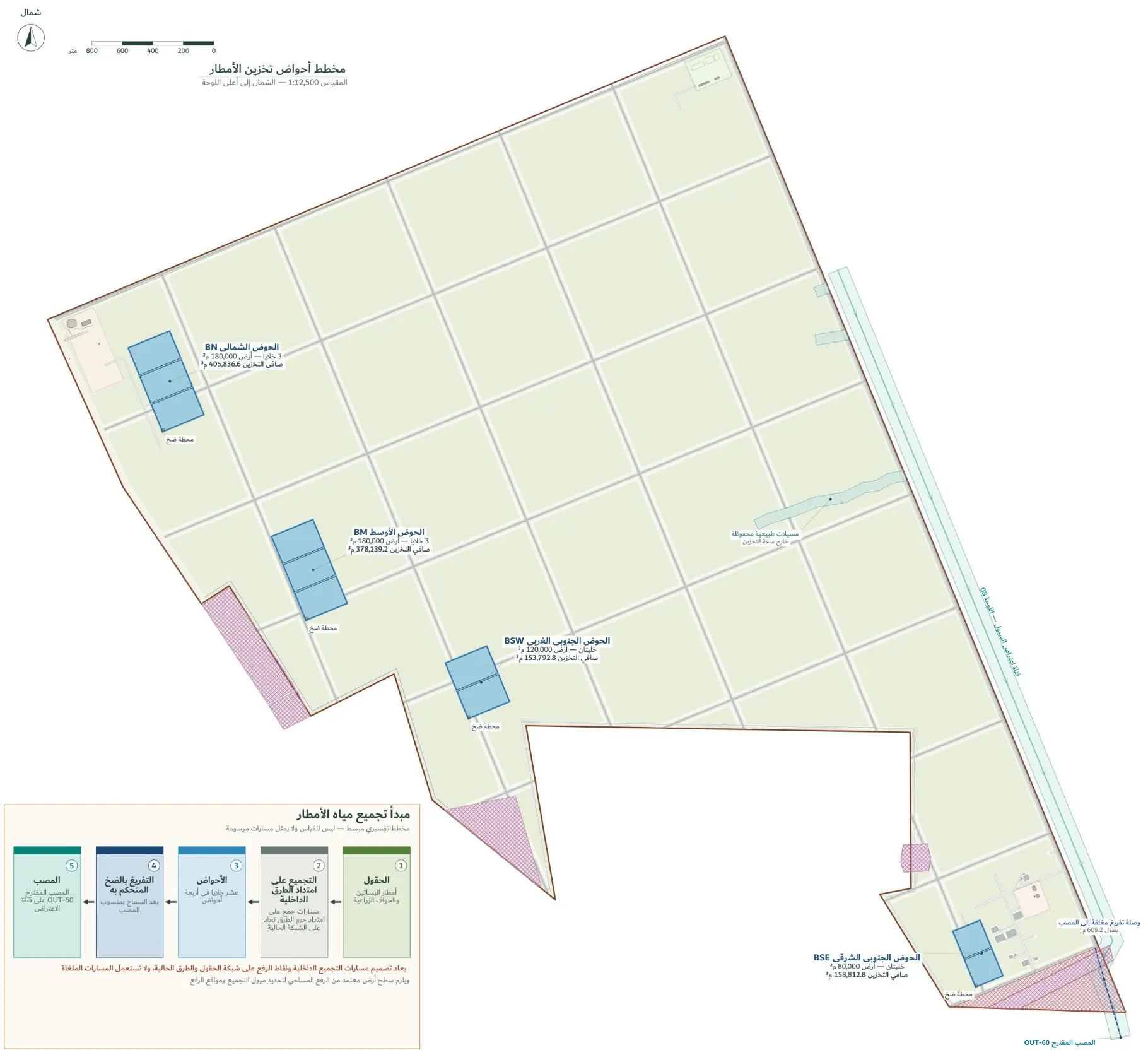
- Four rainwater basins across the site, with the flood channel outside the eastern boundary
Where every square metre goes
| Use | Area m² | Share % |
|---|---|---|
| Planted agricultural core | 15,658,021 | 76.55 |
| Agricultural edges within fields | 1,436,342 | 7.02 |
| Internal and service roads | 1,080,857 | 5.28 |
| Field margins and residual units | 833,982 | 4.08 |
| Rainwater storage basins | 560,000 | 2.74 |
| Constraints: excluded land, high-voltage corridor, cemetery and areas to verify | 416,221 | 2.03 |
| Building and service plots | 214,305 | 1.05 |
| Public frontage and boulevard | 97,864 | 0.48 |
| Preserved natural watercourses | 91,800 | 0.45 |
| Remainder between uses | 66,159 | 0.32 |
| Total | 20,455,552 | 100 |
Each square metre is counted once with no overlap; values are rounded to the nearest square metre.
Site, fields and circulation
Public frontage and buildings
Water: three paths that never mix
1
Floods from outside
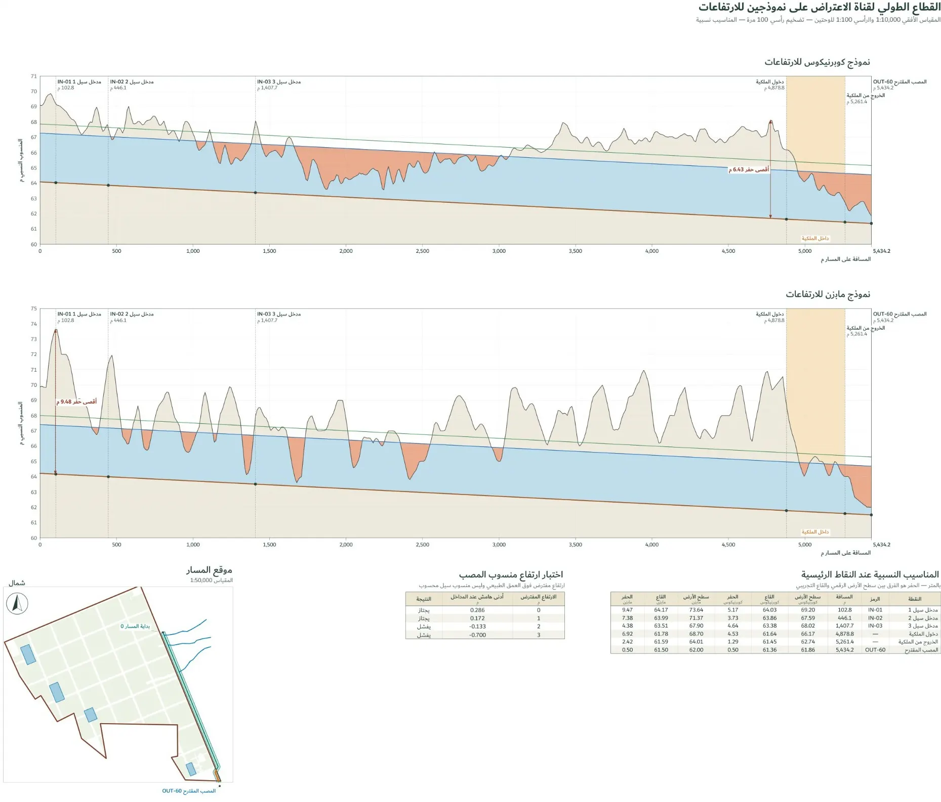
Three wadis descend from the east; a 5,434 m interception channel along the eastern boundary catches the flow before it arrives and diverts it south into a 2,017 m receiving course, within a 130 m landscaped buffer.
2
Rain within the site
Collected along the internal roads into four basins with ten cells — 1,096,581 m³ net after a 10% reserve — and emptied by controlled pumping through a 609 m closed line to the outfall.
3
Irrigation
From the wells to filtration and fertigation, then main lines and field valves to drip irrigation.
The channel has a 40 m bed, 4:1 side slopes and a 0.5‰ longitudinal gradient; at a 100 m³/s test discharge the water depth is 3.19 m with 0.60 m freeboard. A 100 mm rainfall over the site yields about 878,607 m³, leaving a basin margin of about 217,975 m³.
Required before design approval
- 1A survey tied to an approved datum, with a soil investigation
- 2A hydrological study for the design discharge instead of the test discharge
- 3The receiving wadi level to confirm the outfall
- 4Rights of way for the 5,052 m of channel outside the property
- 5Confirmation of the high-voltage line and its corridor with the electricity company
- 6Recalculation of the basins and collection routes on the current field grid
- 7A public-road access point for operations vehicles
- 8Resolution of the 160,441 m² area difference with the brief
This presentation is planning-level masterplanning, not a construction approval or final engineering design.
Source documentation revision · 27 October 2026
Masterplan — R40
Project film
Nakhlan
A visual presentation of Nakhlan, Sabya, Jazan, 2026. Duration 3:31.
3:31
Services shown in this project
Next engagement
If your project needs design intelligence and delivery discipline, let's talk.
Available for selected Saudi engagements covering design coordination, BOQ review, tender packages, and delivery support from design direction to technical package.